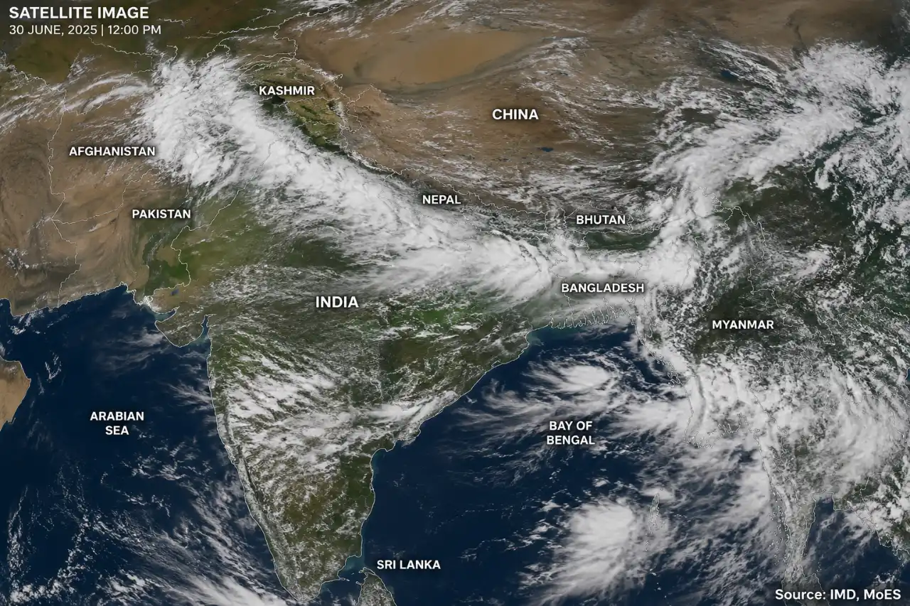
Satellite captures 1,500-km-long monsoon rain band from Bengal to Kashmir (image source: "Chat GPT AI Generated Visuals")
Our Daily Dose of Truth and Trends
Satellite captures 1,500-km-long monsoon rain band from Bengal to Kashmir (image source: "Chat GPT AI Generated Visuals")
After weeks of heat, humidity, and a sluggish monsoon across large parts of India, new satellite imagery reveals a significant shift in weather conditions: a massive band of monsoon rainfall stretching 1,500 kilometers from West Bengal to Jammu & Kashmir. Meteorologists suggest this could mark a crucial turning point for the southwest monsoon, potentially bringing heavy rainfall to several northern states in the coming days.
Satellite imagery shows a vast expanse of dense cloud cover extending from eastern India to the Himalayan region. This weather pattern is linked to the formation of an active monsoon trough, which plays a pivotal role in distributing rainfall across the Indian subcontinent.
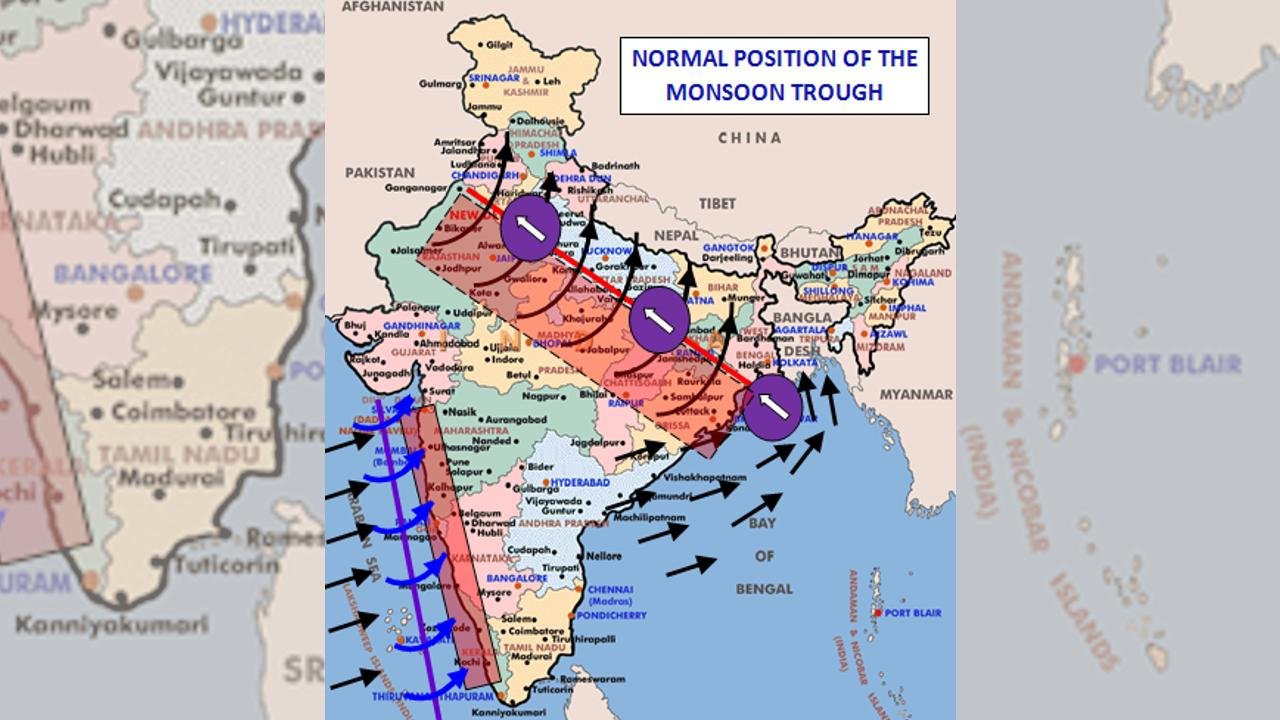
According to the India Meteorological Department (IMD), a monsoon trough has formed, but it is positioned closer to the Himalayan foothills than its normal location. Weather experts anticipate that it will gradually shift southward to its normal position in the coming days; such a movement typically leads to increased thunderstorm activity and improved rainfall distribution across North India.
The monsoon trough is essentially an elongated region of low atmospheric pressure. It acts like a weather highway, drawing moisture-laden winds from the Arabian Sea and the Bay of Bengal and channeling them deep into the Indian mainland. This process leads to cloud formation and rainfall across various regions.
When the trough remains positioned far to the north, rainfall is largely confined to the Himalayan belt, while northern plains—such as Delhi, Haryana, Rajasthan, and western Uttar Pradesh—continue to experience hot and dry conditions. This pattern has prevailed for most of June, resulting in delayed rainfall and a prolonged spell of heat.
Changing weather patterns are raising hopes for millions awaiting relief from the monsoon. Weather forecasting models indicate that thunderstorm activity and rainfall are likely to increase between July 1 and July 4, particularly in Delhi, Punjab, Haryana, western Uttar Pradesh, and parts of Rajasthan.
Interestingly, meteorologists are also monitoring the formation of a new low-pressure system over the Bay of Bengal, which could bring more moisture into the air and further strengthen the monsoon flow.
This shift follows a prolonged spell of intense heat across North India. Recently, temperatures in Delhi crossed 42°C, while some nearby areas recorded temperatures exceeding 45°C, creating uncomfortable conditions due to high humidity. Sustained rainfall could finally bring relief and lead to a significant drop in temperatures.
Meteorologists also note that monsoon systems naturally progress through active and weak phases. Although June was slower than expected in many regions, the rainfall accompanying the monsoon’s resurgence in early July could help make up for the earlier deficit.
For farmers, city dwellers, and water managers, this new spell of rain brings a cautious ray of hope. If the weather forecast holds true and the monsoon trough shifts to its normal position, India could witness a much stronger and more active phase of the monsoon in the coming days—bringing much-needed rainfall after a difficult start to the season.